Maps R Us
Back in 2001 when I moved from Nanaimo to work for the Coquitlam School District, I recall having to buy a “good” map book to find my 

My son and I were talking the other night about how online maps significantly improve a part of his business. He runs a property services business called Clean R Look and needs to quote jobs all over the lower mainland. Rather than drive out to businesses, stratas, and homes, he uses Google Earth. He plugs in the address and ‘looks around’ the property. He uses the ruler function to 
One of our District Principals was in my office last week and we were going through the locations of all of our alternate schools and programs. I needed to know exactly where they are to be able to plug them into the correct IT service area for a new organization model we’re implementing. We would pick a school, he would think about where in the city it was, I plug the street name into Google Maps and we ‘go there’ to find it’s exact location. I am impressed with how quickly and accurately Google Maps predicts places as you type. Also, it has become very good at taking the name of a place, a school for instance, and finding it instantly. My colleague isn’t super tech savvy so I’m like to sell him on the power of tech to transform what we do – I emphasized maps during this meeting. He shared that when he and others get together to figure out locations for planning, they crack open the paper maps and place them on a large table. In good fun I in no uncertain terms told him ‘you have to stop doing that and use technology – it makes your life so much easier’. But seriously, paper maps, globes, atlases, etc. are so ‘last year’ and we all really need to understand the transformative power of digital maps.
Google Earth is a powerful learning tool - here’s a hypothetical example involving Renfrew Elementary School in Vancouver. Get each class K-7 to do some run route design for PE class and distance estimating. Start simple with the school field. Have the kids manually go out and try to measure / estimate a loop around the field and then represent that in centimeters, meters, kilometers, inches, feet, and miles teaching them about conversion formulas. Then have them do the same work using Google Earth and then write about the experience, which they preferred, especially if they had to 
Other Google Earth activities could include:
- kids using their mobile devices to take pictures in the neighborhood, saving them up to Flickr or the school website, and adding the photos to the Google Map as a layer
- kids identifying interesting spots in the neighborhood and adding place markers to identify them
- having kids them research the neighborhood using school archives and the Internet and adding links to interesting historical content they find, pinned to specific locations
- having the kids record tours of the school grounds, the neighborhood, and adding them to the area
- getting two schools in different parts of the School District to partner up on these activities and present them to each other using Skype or some other video conferencing tool
I think Google Maps and Earth should include the ability to connect Augmented Reality (AR) auras as a layer. Perhaps the various AR apps could collaborate on a standard for this so auras created in any would work in all. A user could be viewing a Google Map on their phone and turn on the aura layer so that as they navigate, auras 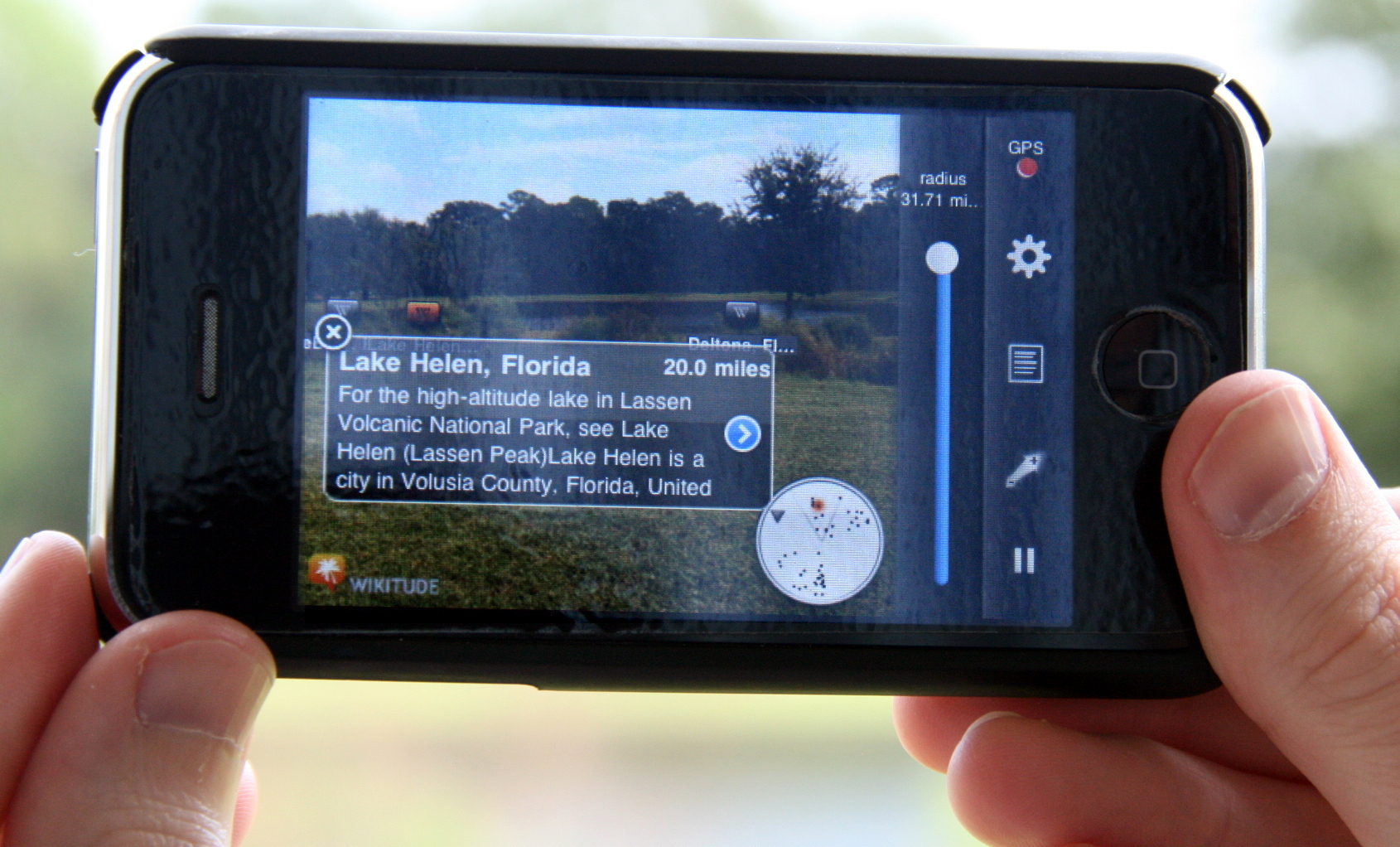 would activate in real time. Or perhaps they could have the map in a translucent mode so they can look around through their device camera and auras would be triggered from the various AR providers. I think the lines between real and augmented are going to become blurrier in the coming years. Think about where Google Glasses and similar tools might take us (ignoring the dark / evil side of this for now). The future really is an interesting place to go…

Comments
Post a Comment